Majuro Atoll, the Marshall Islands. 13th of September 2025.
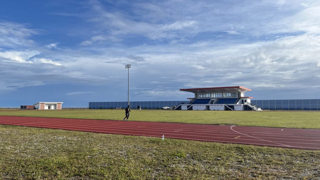
We laced up before sunrise and set out for a run like no other. The Majuro Track and Field Stadium sat right on the edge of the Pacific, with the ocean on one side and a bright white cemetery on the other. It felt surreal to start our 5k surrounded by so much local life and scenery 🌊.
The track was smooth, the morning air was cool, and I could not believe we were running in the Marshall Islands.
The run started slow but soon turned into a tempo effort. The sun climbed, the pace quickened, and clouds gathered in the distance. A few local runners came and went, adding to the energy of the morning 🌄.
By the last laps, I was tired yet completely alive, pushing through the humid air and finishing with a smile.
Running here was more than training, it was a memory stitched to the ocean breeze.
TLDR; “too long, didn’t read”
- I just want to run! Take me to RUN.
- I have 1 minute. Take me to USEFUL INFORMATION.
- Running is my excuse for travelling. Take me to TRIP.
- Running is my excuse for eating. Take me to CARBOLOADING.
- I want to know what to read in the plane. Take me to ONE BOOK.
📌 Why Marshall Islands Should Be on Every Runner’s Bucket List
Before you write off the Marshall Islands as just another tropical escape, consider this: it might be one of the most unique and soul-stirring running destinations on Earth.
With its remote coral atolls, WWII battle trails, and uninterrupted sea views, every step here carries history and heart. 🏃♂️🌊
Whether you’re a seasoned marathoner or a curious explorer with a pair of sneakers, this place rewards your effort with unforgettable sights, sounds, and stories. Plus, they have a very good Track and Field Stadium!
Apart from the Track and Field option, let’s look at why this remote Pacific paradise deserves a top spot on your runner’s bucket list:
- Terrain variety – soft coral sand, reef-crossing causeways, and WWII trails
- Tropical challenge – warm, humid air that strengthens endurance 💪🌞
- Instant recovery – swim in emerald lagoons or sip a cold coconut after your cooldown 🥥
- Island community – locals wave, smile, and share stories as you run. Run with friends, not just scenery 😄👋
Running in the Marshall Islands isn’t just about fitness, it’s a way to connect deeply with the land and the people.
You’re not pounding pavement in a city. You’re in an Atoll tracing shorelines, weaving through villages, and jogging past sunken tanks and rusting bunkers.
It’s the kind of running that clears your head and fills your soul. 🌺👣
🏝️ What to See in the Majuro Atoll in the Marshall Islands
Running in the Marshall Islands is just the start of your adventure. Because this place is packed with incredible sights to explore when you’re off the trail. 🌴✨
From haunting WWII relics from crystal-clear lagoons, there’s something for every kind of traveler (and runner!) to discover!
So lace up your shoes, but don’t forget your explorer’s spirit. There’s a whole world waiting just beyond the running path. 🏝️👀
📜 A Brief Story of the Marshall Islands
The Marshall Islands, 29 atolls and 5 islands spread across the central Pacific, carry a deep, remarkable history. During World War II, Kwajalein Atoll became a pivotal battleground in the US’s Pacific campaign.
The massive Operation Flintlock in 1944 was one of the largest amphibious assaults ever. Today, you can still run past crumbling bunkers, beached tanks, and corroded acid barrels. Ghostly reminders of fierce conflict and survival. 🏝️🔱
Beyond the war, the islands endured nuclear testing during the 1940s–50s, especially at Bikini and Enewetak Atolls, leaving scars and stories of displacement, resilience, and hope.
Today’s Marshallese are proud, resilient keepers of tradition. Welcoming you with open arms while honoring their past. Running through these islands, you step into layers of beauty, history, and tenacity. 🌬️👣
🌍 The Trip 📷
Unexpected Stop in Nauru ✈️
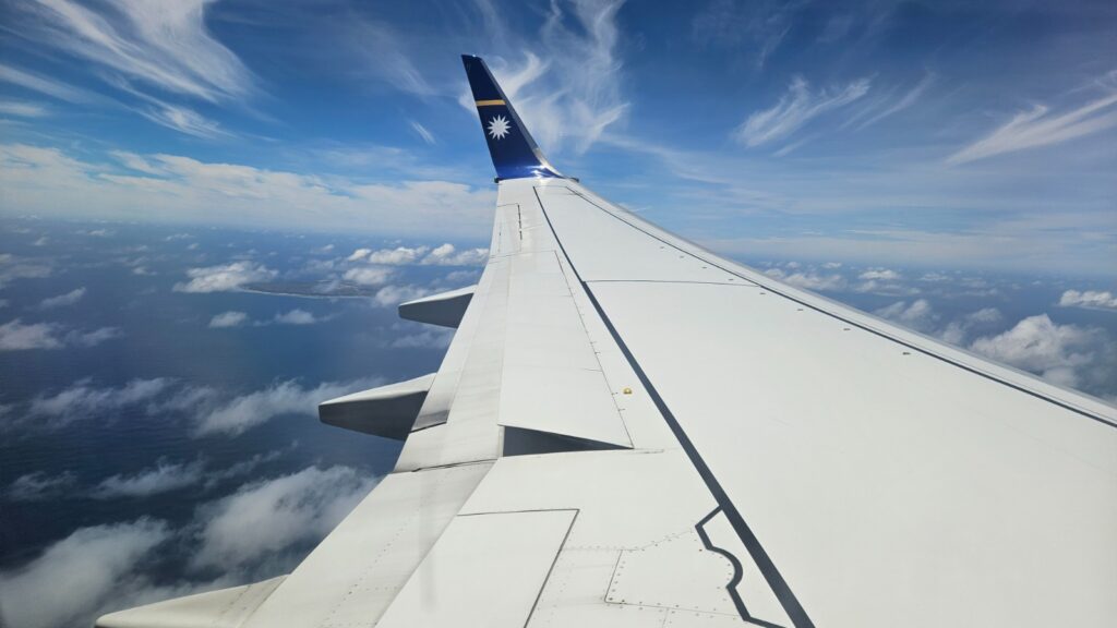
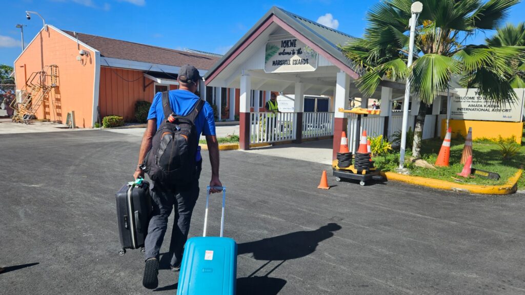
I started writing this blog entry in Nauru, which wouldn’t be surprising if this was part of our flight plan, but it wasn’t. Our direct flight from Tarawa to Majuro was supposed to take just one hour. We boarded Nauru Airlines ON041 and even knew the flight number by heart after so much checking. 🛫
We took off half an hour late, which wasn’t too bad. The Boeing 737 wasn’t small, and we were served an omelette and bacon sandwich with some potato crisps and Doritos. We were happy with the snack. About 50 minutes in, the crew announced landing procedures. Roger pointed out an island in the middle of the ocean through the window. 🌊
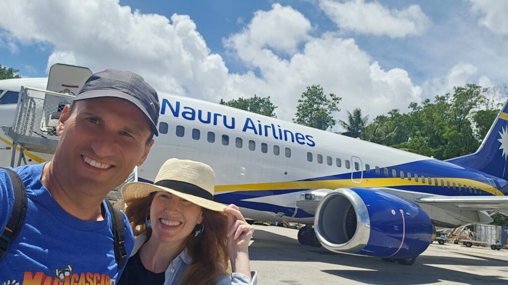
We checked Google Maps and it was Nauru. The shape matched perfectly. But why were we landing? Marshall Islands were far away. Panic set in. We nervously checked our boarding passes and flight emails. They all read Majuro. No mention of Nauru at all. Yet we approached the island and landed. I took pictures of the airport wall that read Welcome to Nauru. 📸
Exploring Nauru Airport 🏝️
Nobody stayed on the plane. Everyone had to disembark. The air hostess confirmed we needed to leave. What the heck! They changed the route and didn’t inform passengers. 😳
I took a selfie in front of Nauru International Airport. We hadn’t officially been to Nauru, but at least we had a selfie!
It was 12:30, and we were supposed to land at Majuro at 9am. More than three hours had passed, and we were stuck in another country. Roger decided to nap on the ugly carpet. 😴
Back on the Plane to Majuro ✈️
At 1:30pm we finally boarded again. Seats were changed. My seat moved from 18A to 18C while Roger stayed in 18B. Could have been worse. We boarded a smaller, older Boeing 737 with the same crew. Hello again, we greeted them. Inside it was extremely hot, and the crew thanked us for our understanding. We still didn’t understand why the plane had stopped in Nauru. 🥵
Arrival in Majuro 🌴
Carmen from Fiji, mother of the B&B owner, picked us up.
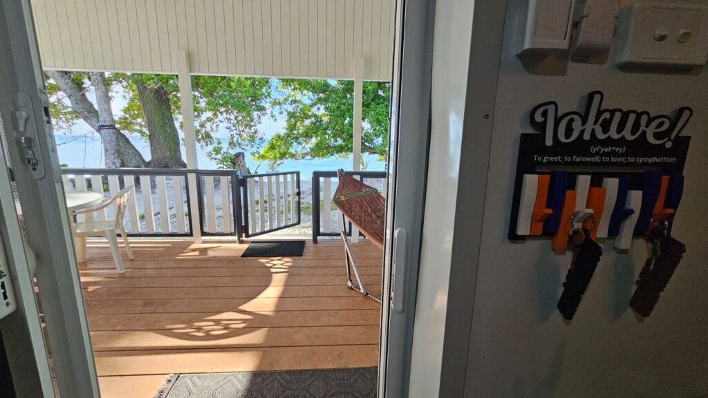
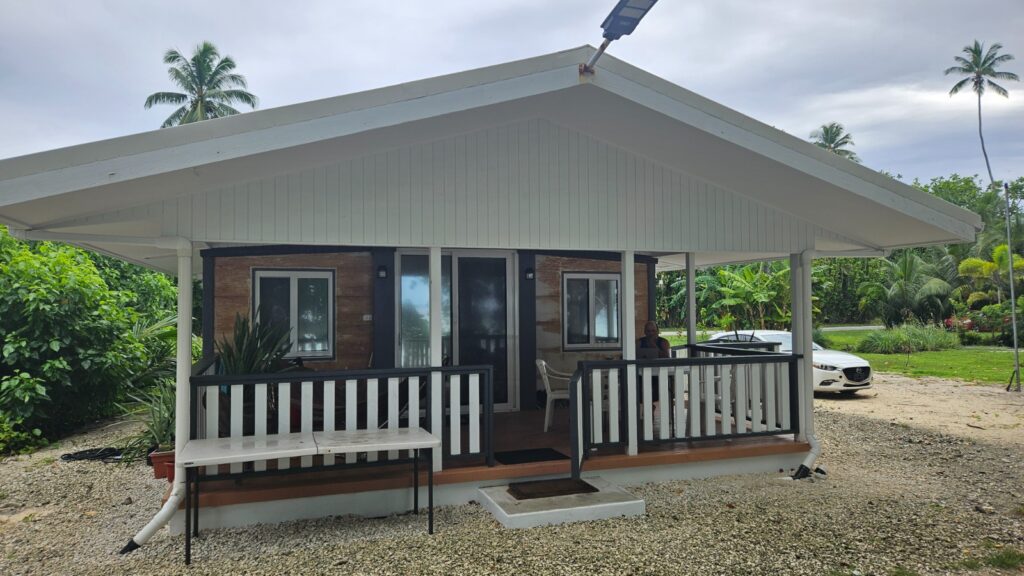
The house we rented was amazing, new, well taken care of, decorated beautifully, and with appliances ready. It was called “Container Home” because… it was constructed with three Shipping Containers!
Best of all, it had the beach right there! We could walk from the terrace directly onto the sand. 🏖️
Carmen explained that the beach had been much larger seven years ago before her home was built. Climate change?
We couldn’t wait and tried snorkeling. We saw a few fishes and a few tires. She also warned that running down the beach wasn’t safe because of random dogs.
Carmen lent us her car. We had some trouble starting it and had to video call, but finally succeeded. 🚗
Scenic Drive Through Majuro 🌅
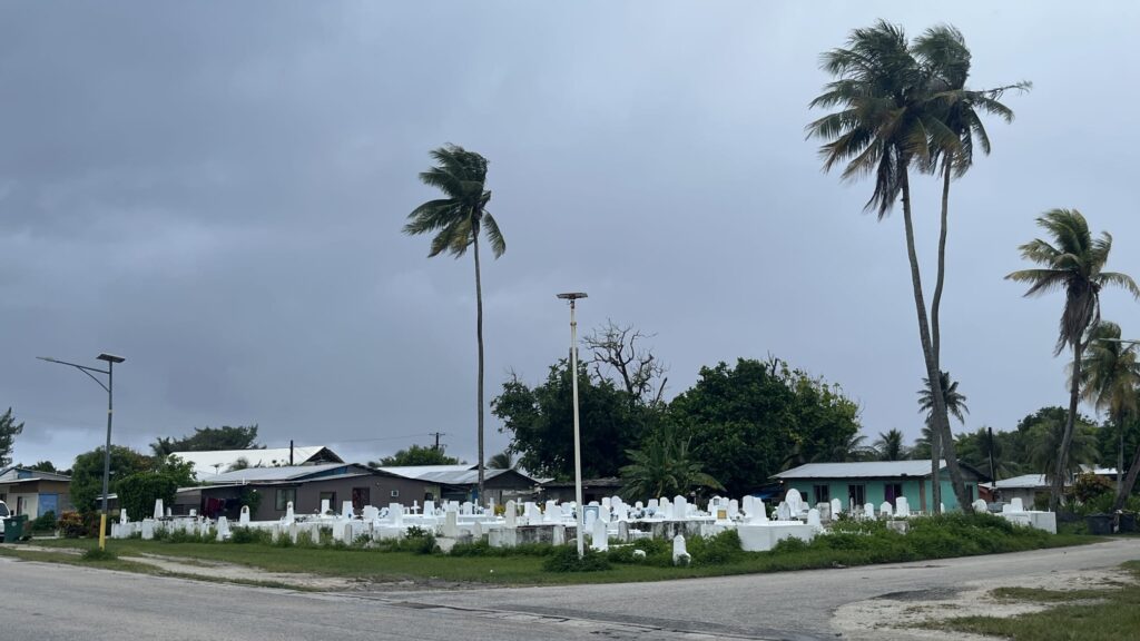
Our one-hour drive began, and I immediately liked the Marshall Islands. Everything was green, clean, and the houses well-kept. Palm trees swayed with sunset orange rays filtering through. Two Mormons rode bicycles along the road, and a shabby restaurant held a hopeful sign, “We Are Open” 🌴
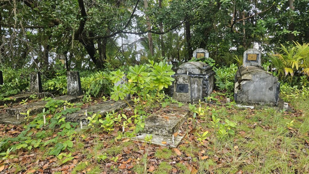
We passed a copra processing plant, solar-powered street lamps, and a well-kept cemetery with bright white tombstones. Two graves were under a roof lit by a single fluorescent tube, oddly resembling a garage. Men chatted in plastic chairs under a tree. It felt like a movie scene. 🎬
Then we realized a blunder. We had driven to the opposite end of the island. Forty-two kilometers remained, more than an hour of driving. Night was falling, and everyone drove with high beams. People walked dangerously close to the roadside without reflective vests. Still, speed bumps were marked.
The whole drive felt unique and special, a perfect introduction to running in Majuro and exploring the Marshall Islands by road. 🌅
Exploring Majuro Atoll from North to South 🌴
Our second day in the Marshall Islands started with a car we rented from our Airbnb. We planned to explore Majuro Atoll from the far western tip all the way to Delap–Uliga–Darrit, the urban center. That’s more than 50 kilometers, about a two-hour drive. And yes, we actually drove it twice. 🚗
Leaving the Track and Field, we headed south to run to the Majuro Bridge.
Mini Run under the Rain!
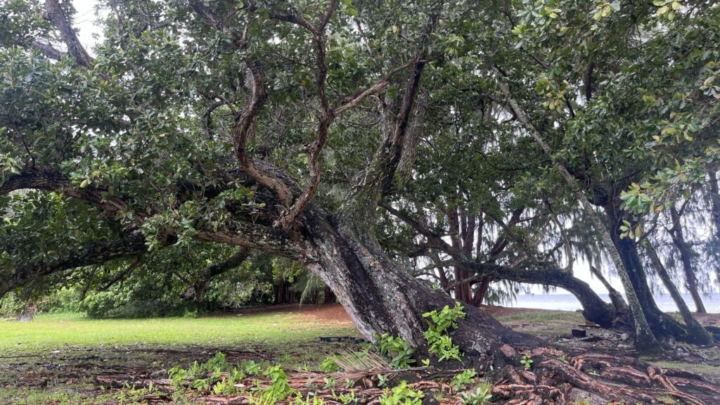
It was raining heavily but we weren’t deterred and ran! I loved it. Rain always feels better than scorching sun. We ran under big trees, surrounded by vibrant greenery.
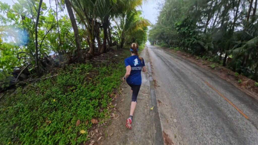
A sidewalk kept us safe from the heavier traffic, which in Majuro is dominated by cars rather than scooters. 🌧️

After half a kilometer, we reached the bridge entrance. Instead of crossing, we turned left to a pier being hit by storm waves. It was incredible.
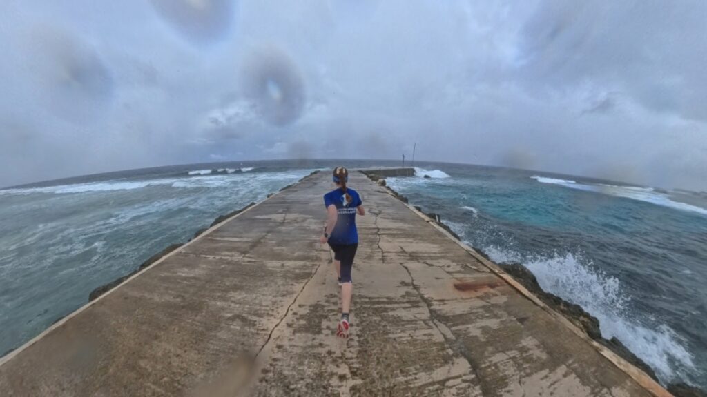
We had to be careful on the slippery surface and avoid the waves. Hundreds of crabs ran under our feet. Nature felt alive and wild.
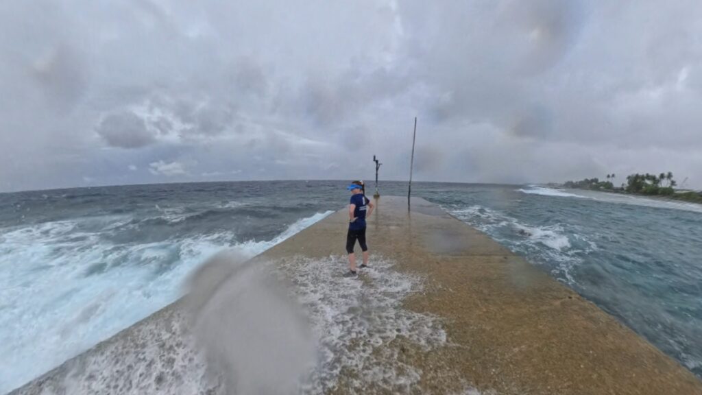
This short run connected me to the raw energy of Majuro’s coastline. 🦀
Lagoon Road Adventures 🚲
After our pier run, we returned to the Container Home and set off south. Driving along Lagoon Road, we noticed so many unique scenes. Two white Mormon missionaries in shirts and ties rode bicycles holding umbrellas. A big fat kid jumped joyfully in the rain, and a man mowed grass while another gardened.
We drove 27 kilometers listening to Radio Australia, which broadcasted PNG’s independence celebrations from Brisbane. The announcer kept saying “It’s fantastic, fantastic” and “It’s amazing, amazing,” making the ride feel even more surreal.
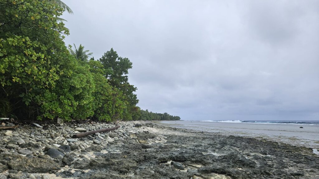
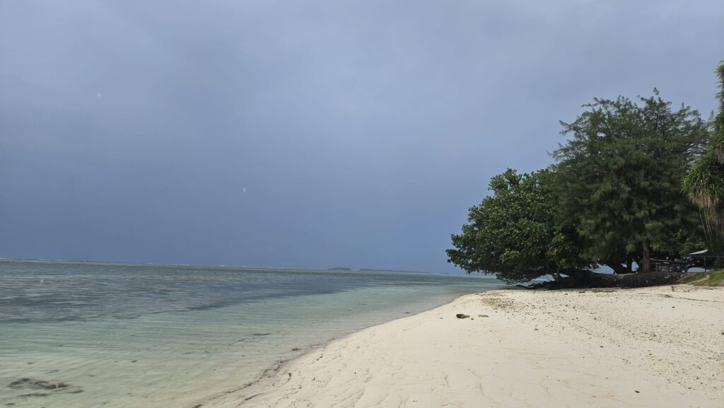
Still, being alone on that beach felt magical. This is one of the few broad, swimmable beaches in Majuro, and its wild beauty under rain made it unforgettable. 🌊
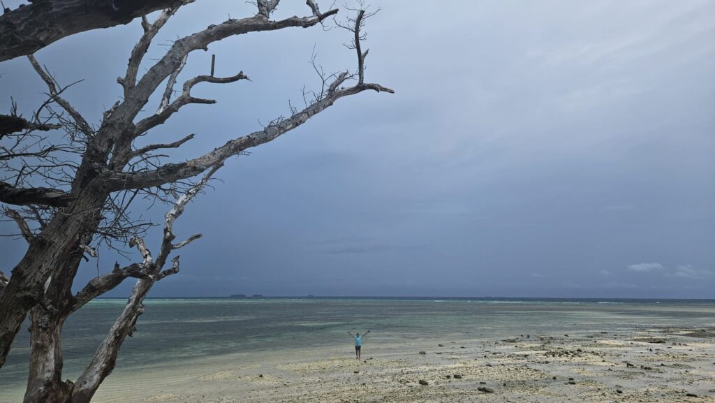
Finally, we reached Laura Beach, a wide sandy stretch where the thin road ends. 🏖️
Laura Beach was empty. The rain added a strange sense of connection with nature and the place. I tried writing lines for this blog while Roger snorkeled, but my fingers were cold and wet.
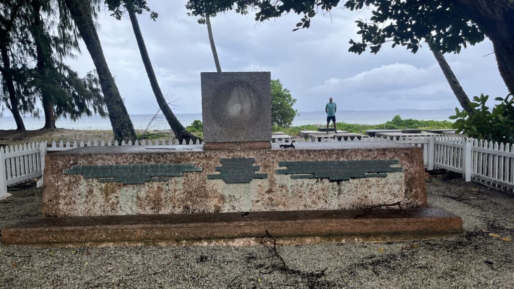
History and Reflection at the Typhoon Monument ⛪
On the way back, we stopped at the Typhoon Monument in Laura. It commemorates victims of a devastating typhoon from the early 1900s.
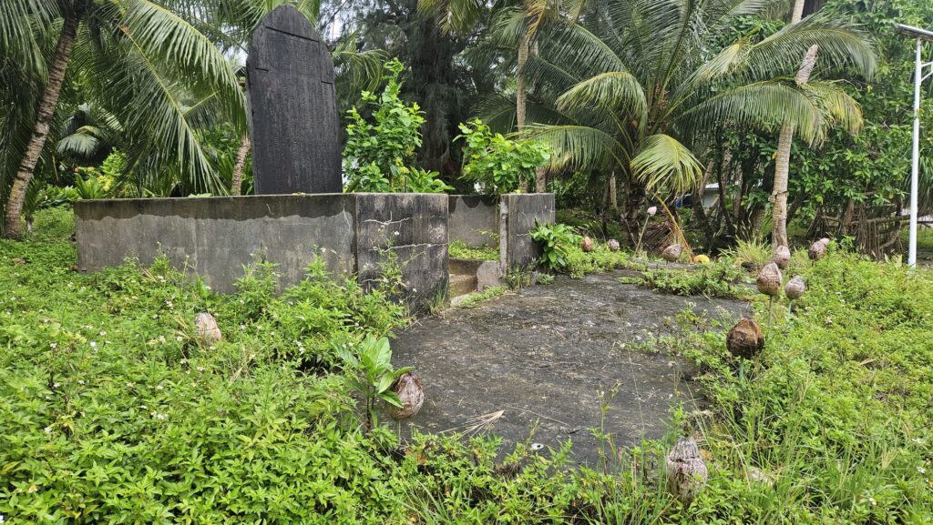
Small but moving, it reminds visitors of the vulnerability of atoll nations to natural disasters and climate change. Local people emphasize its cultural importance.
We also visited several familiar spots along the drive. Beautiful cemeteries caught our attention, from white stone graves adorned with flowers overlooking the Blue Lagoon,
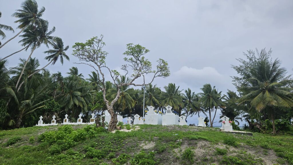
to hidden graves surrounded by lush vegetation.
Churches also stood out, including the Ajeitake United Church of Christ.
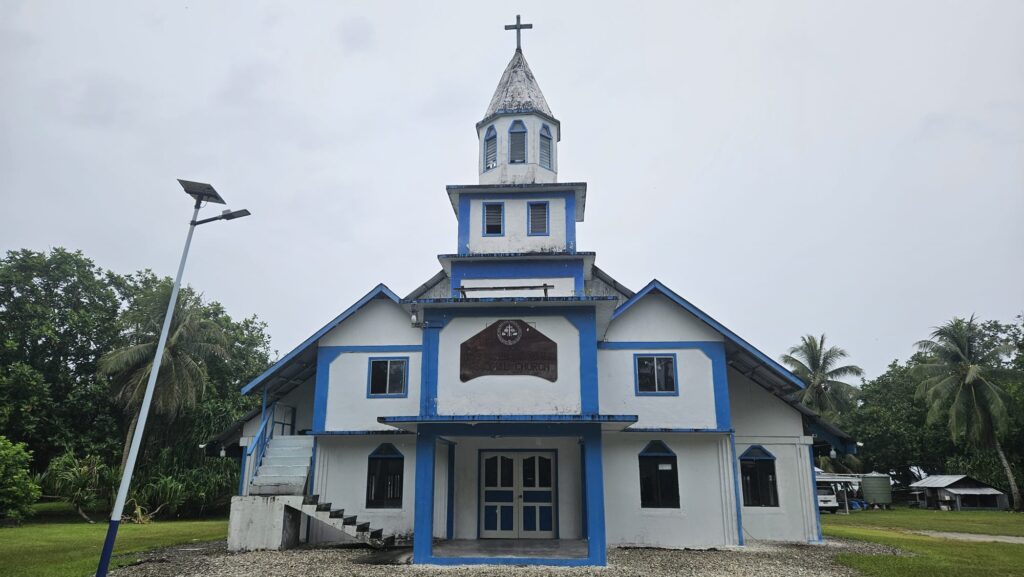
Majuro is home to Roman Catholics, Protestants, Mormons, and Seventh-day Adventists, reflecting its diverse Christian faiths. ⛪
Finally, we stopped at Majuro Memorial Park.
This quiet, reflective spot honors those who lost their lives during World War II and Marshallese leaders. Shaded pathways and stone markers make it a peaceful stop.
History feels close here, stretching back to January 1944 when U.S. forces transformed Majuro into a forward naval base. 🏟️
Majuro Urban Life and Lagoon Views 🌅
Majuro became a safe harbor for aircraft carriers and battleships. Airstrips and support facilities were built, and from here the Allies launched operations across the Central Pacific. Most wartime installations are gone now, but traces remain in concrete foundations, rusted machinery, and family memories.
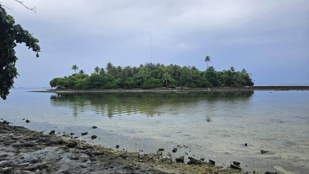
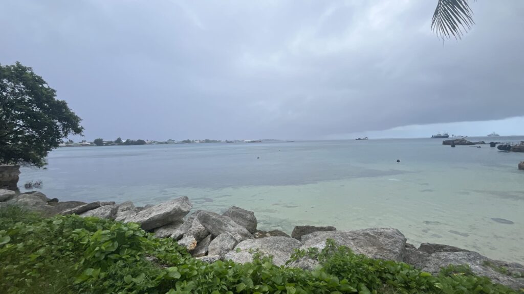
We had lunch in the urban center of Delap–Uliga–Darrit, also called Town. Afterward, we explored the far east of the atoll. From there, we enjoyed a stunning view of islands scattered across the lagoon.
This full-day journey across Majuro Atoll from west to east, with running, rain, and history, felt like the perfect way to discover the heart of the Marshall Islands. 🌴
🏃♀️ The Run 🏃♂️
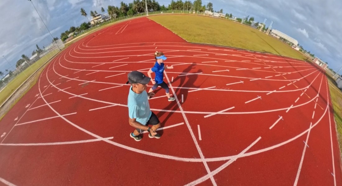
Running Track and Field… Over the Ocean 🌅
We woke up before the sun at 5am. It was so dark that we finally left the house around 6:30am. This gave us the chance to enjoy the sunrise, which over the Pacific Ocean was particularly magic. 🌊
Since we were in an Airbnb accommodation, we ate what we had bought yesterday in the supermarket for breakfast. I had two toasts with a local hazelnut spread branded Signature Select. It resembled Nutella but it was not quite the same. Sorry, Nutella. 🍞
The plan was simple. Run in the Majuro Track and Field Stadium. Yesterday we asked our host if it was safe to run in the area. She advised against it because of many random dogs.
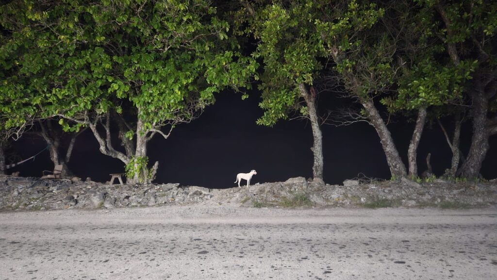
After our incidents in Tuvalu and Tonga, I had enough of dogs. When she mentioned that there was a Track and Field Stadium where many people trained, we decided on a different run. It would also be good to use it as a tempo run. 🐕
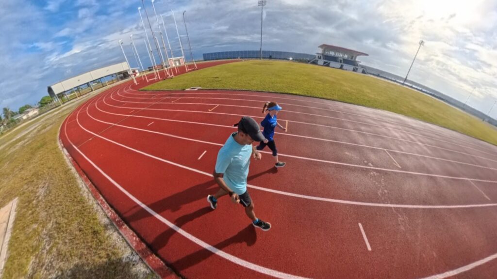
On our way to the Track and Field Stadium, we saw a couple of local runners. That lifted our spirits. We also passed Majuro Bridge and its nearby dock, where we decided we would attempt a run. Seeing runners there made me excited about running in the Marshall Islands. 🏃
First Impressions at the Dock 🏟️
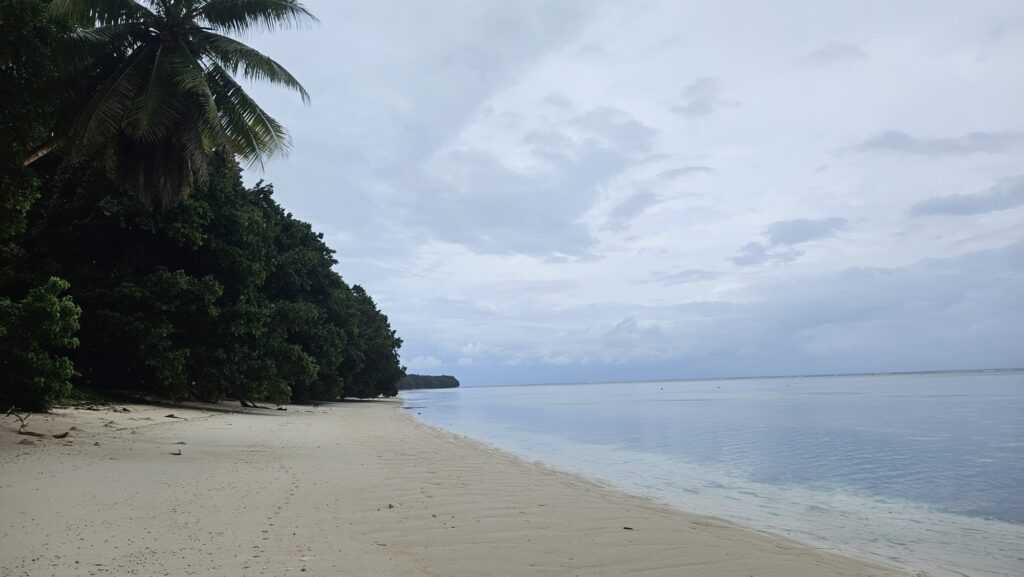
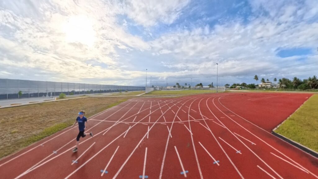
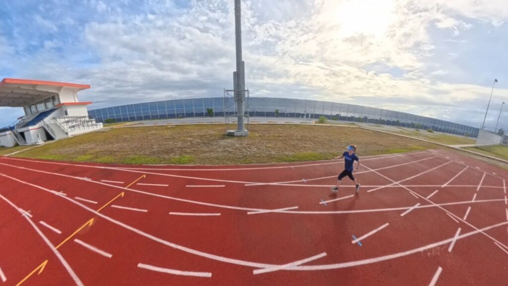
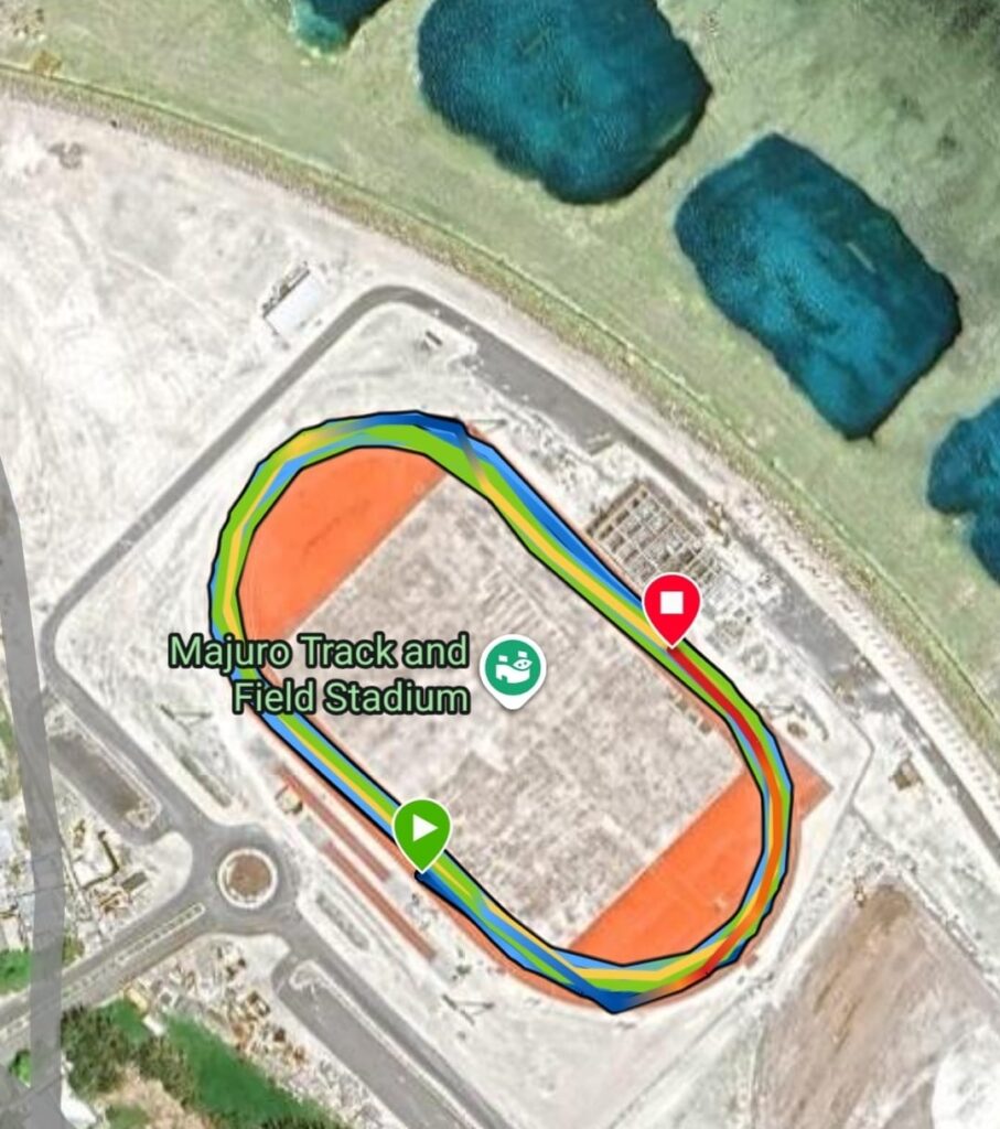
We arrived at the dock around 7am and were pleasantly surprised. It was a proper stadium. The track was in excellent condition and the views were breathtaking. The ocean was right there. On the other side was a local cemetery, so beautiful, well kept, with tombs painted in white and decorated with flowers. That detail added a local touch. 🌺
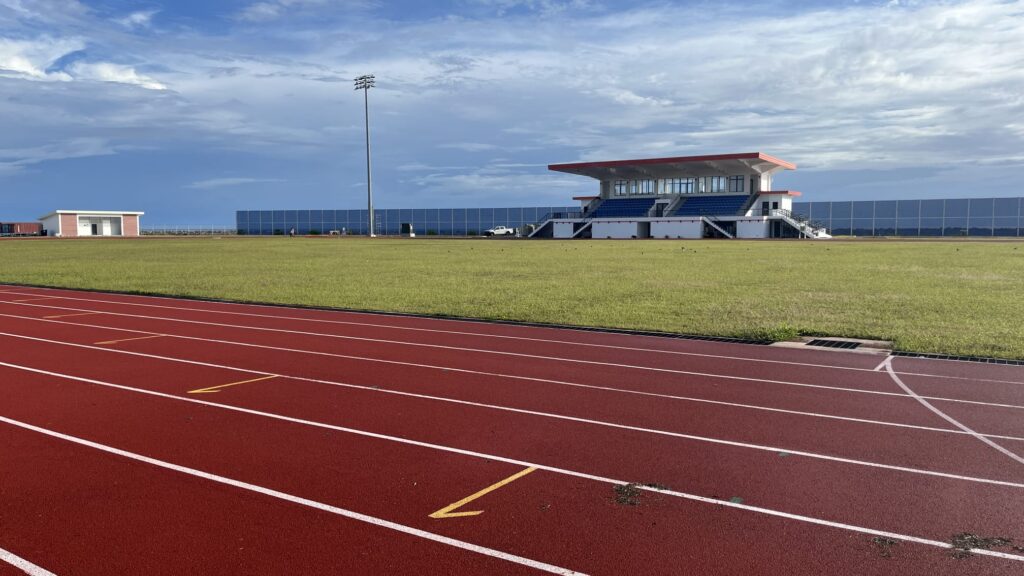
This was not only a stadium. It was a multi-use complex with a track, soccer field, and space for community events. Beyond athletics, it was one of the few places in the Marshall Islands where large gatherings, celebrations, and international events were hosted. It had seen everything from sports tournaments to cultural festivals. 🏐
We also realised that the stadium had been built with the cooperation of the government of Taiwan. Later, we saw many other examples of the relationship between the two countries.
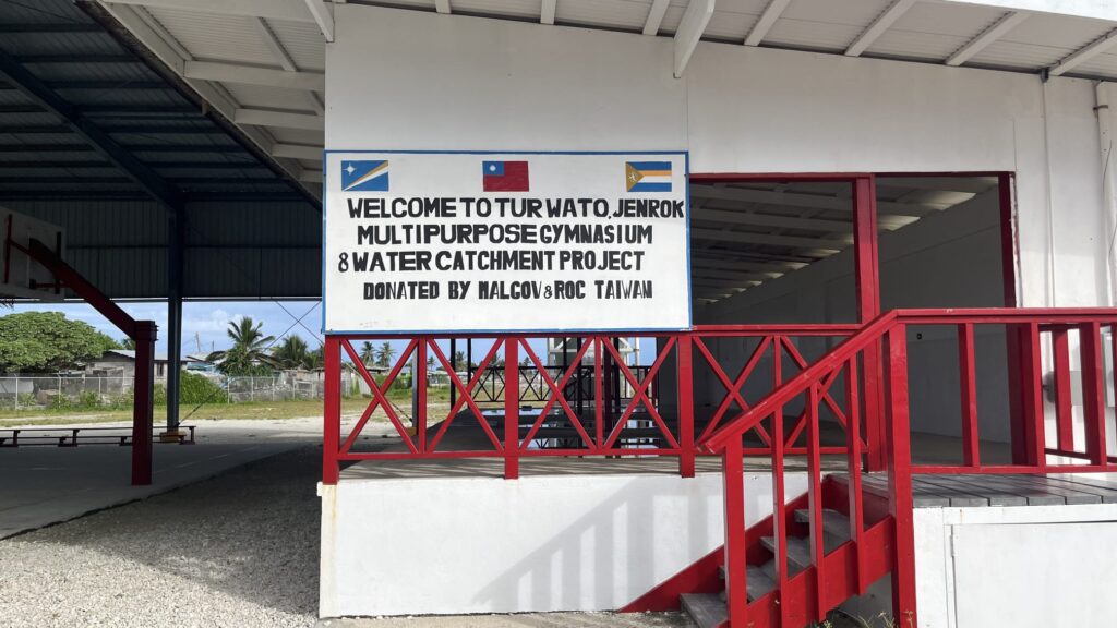
The Marshall Islands is one of the few countries in the Pacific that officially recognises Taiwan instead of mainland China. They have had diplomatic relations since 1998. Taiwan provides development aid, medical teams, scholarships, and infrastructure support. That is why so many Taiwanese-funded projects can be seen around Majuro, from agriculture programs to health initiatives and construction projects. 🌏
Time to Run 👟
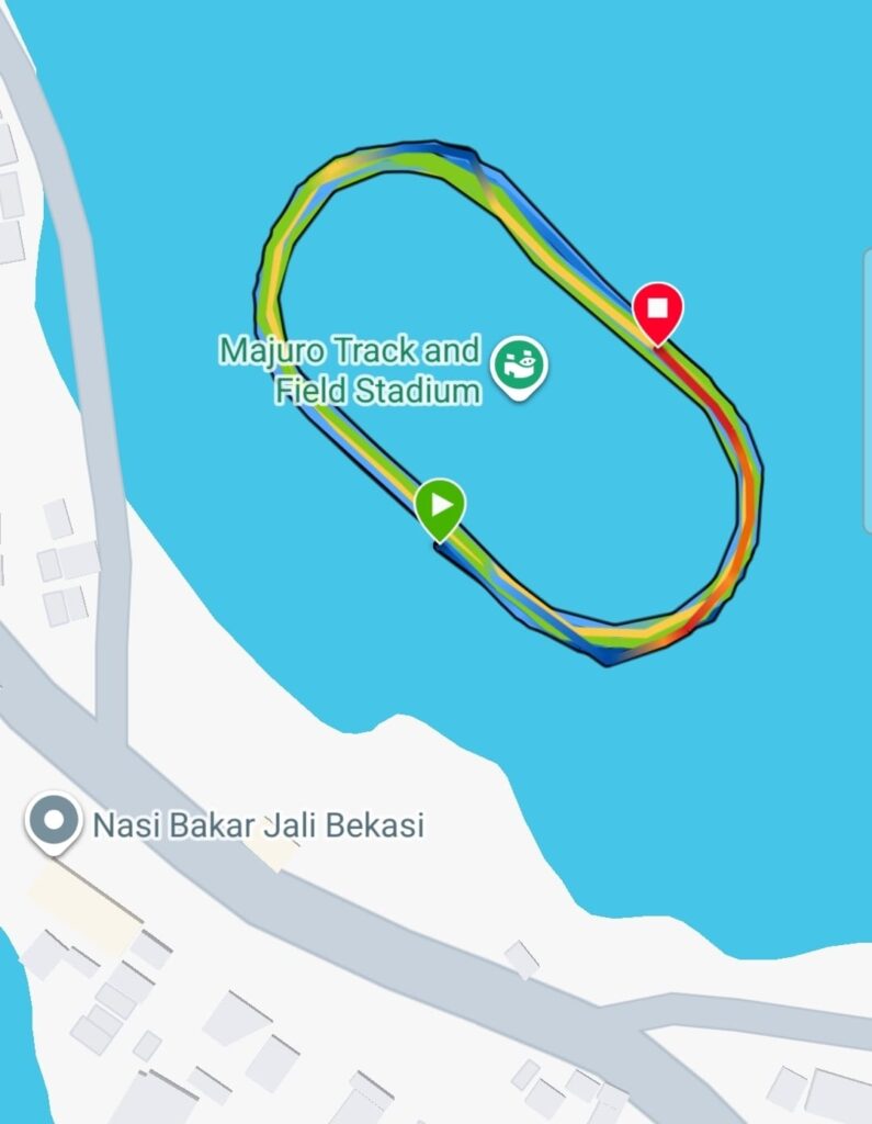
So we set off with the objective of a 5k. We ran in the exterior lanes. Roger ran in the longest one and I in the next. Every lap was more than 400 metres so we had to run fewer laps. It was still not too hot so we progressed well. ☀️
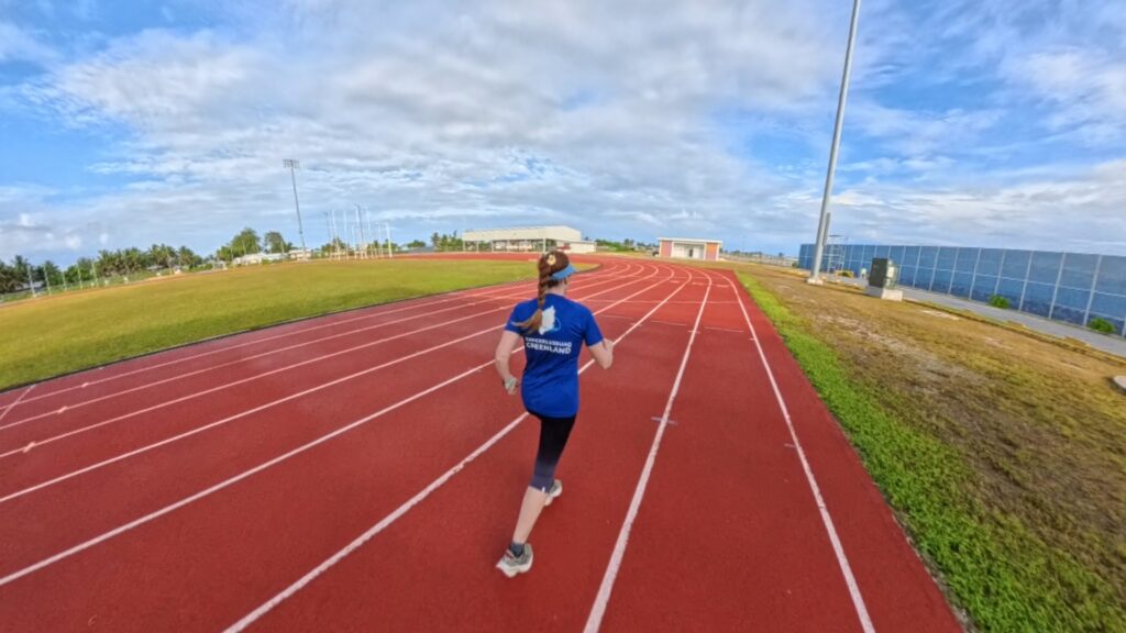
I started slowly as these days I noticed it takes me longer to warm up. After a couple of laps, we picked up the pace. We were running at 5:30 minutes per kilometre.
That pace used to feel comfortable a couple of years ago. After my surgery, it felt more like a tempo. 🕒
There was only one local runner, who left after our third lap. Then we were running by ourselves. The sun started to rise and we felt the temperature rising.
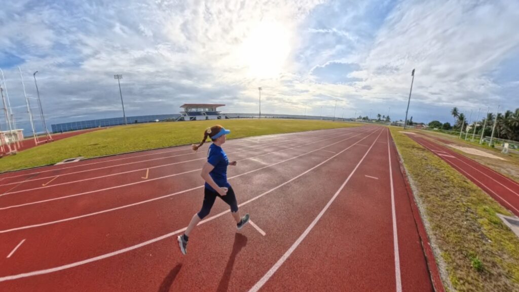
At 2.5 kilometres, two white runners arrived. They were young and ran at a good pace. The track filled with vibrant morning energy. 🌄
Dark clouds appeared on the horizon. The sky was menacing but also extremely beautiful. Roger was running longer than me, so he started to fall behind. I pushed to 5:20 minutes per kilometre.
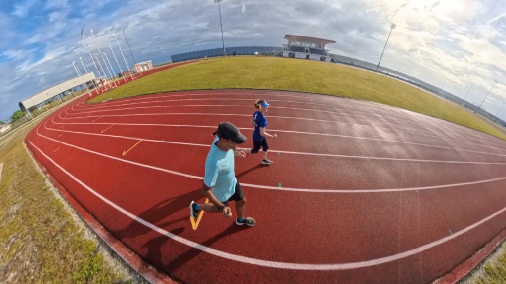
I thought about how this track running in Kiribati’s neighbor, the Marshall Islands, was an unforgettable experience. 🌧️
The Last Push and the Rain 💨
At kilometre four, Roger suddenly picked up the pace and caught me. He approached and said, “We are going to finish together. Last metres.” I was struggling but managed to answer, “What? There is one kilometre left.” He shouted, “One kilometre?” 😂
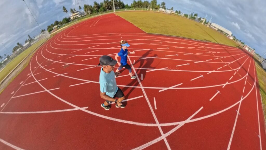
Apparently, Roger had run 4.8 kilometres in the time I had run 4.2 kilometres because of the difference in running a longer lane. He stopped, while I still had to run another 500 metres. That made me laugh as I pushed through the final stretch. 💪
Anyway, I was happy with my 28 minutes while Roger ran 25 minutes. Not too shabby after months of training only for stamina to finish the Sydney Marathon.
It reminded me that running in Majuro was not just about pace. It was about joy and discovery. 🏅
And right when we finished, it started raining. The funny thing was it never stopped raining for the rest of the day. Basically, the only time when the sun was shining was during our last laps. 🌦️
What to Eat and Where to Eat in Marshall Islands
In “Town”, that is, Delap-Uliga-Darrit, I highly recommend the restaurant Toeak.
The restaurant is located on the 5th floor of a building where you can find either an office of the “Big 4” consultancy Ernst and Young and the headquarters of the Marshall Islands Olympic committee. How weird!
We climbed the stairs and were surprised to see the decoration. A couple of black-and-white photos of Majuro’s lagoon covered in U.S. warplanes hung on the wall.
It was surreal to think that the same calm waters we see today once hosted one of the busiest naval anchorages of the Pacific War.
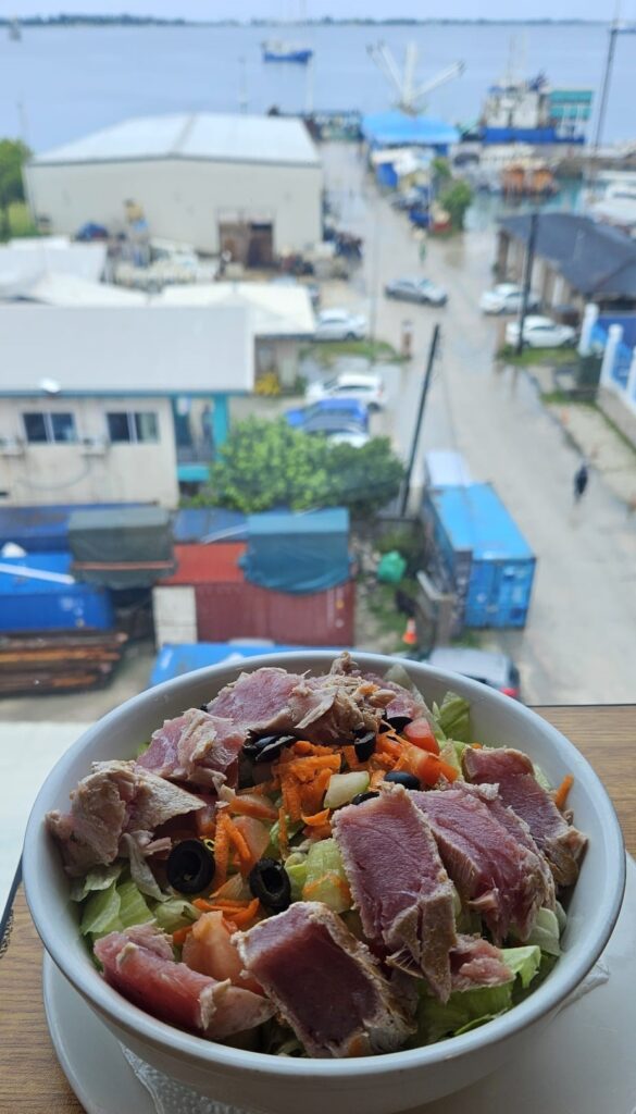
The restaurant also has amazing views of the harbour, so it made sense to have a seared tuna salad and some fried fish! Excellent.
And what else can you eat?
Get ready to fuel up and recover island-style! Whether you’re bracing for that first stride at dawn or cooling down under swaying palms, the Marshallese table has you covered with hearty, tropical flavors mixed with a playful twist.
Fuel your adventure the right way and savor local treats while your muscles thank you!
🥥 Carboloading (Before the Run)
- Pan bread with coconut butter – Soft local flatbread spread with creamy coconut—quick, light, and tropical 🍞🌴
- Pineapple-banana-papaya bowl – A hydrating, vibrant medley of quick carbs and electrolytes 🍍🍌
- Rice porridge with coconut & a drizzle of honey – Comfortingly smooth energy that won’t weigh you down
🐟 Protein Recovery (After the Run)
- Grilled reef fish & breadfruit – Lean local protein paired with filling island starch 🐠🍠
- Taro & coconut fish stew – A rich, creamy stew that soaks your post-run soul in flavor
- Coconut crab salad – Slightly adventurous, totally delicious—get that protein with an island twist 🦀

Useful information
🏃 Running in Majuro Atoll, the Marshall Islands, Oceania.
👟 Urban: bring shoes for asphalt, as Lagoon Road is on good condition. Even track shoes if you have them and want to train in the Track and Field Stadium!
✅ The stadium track is in excellent condition and right by the ocean, giving incredible views while you run. 🌊
✅ The sunrise over the Pacific makes the run unforgettable and energizing, even before the island fully wakes up. 🌄
⚠️ Stray dogs can be an issue outside the track, so stick to the stadium for safety. 🐕

Map
One book
📘 “Melal: a Novel of the Pacific” by Robert Barclay
Set during Good Friday 1981, Melal follows brothers Rujen Keju and his sons as they navigate life on Majuro and outer atolls, standing at the crossroads of tradition, colonial influence, and spiritual heritage. The story weaves family drama, community conflict, spiritual revelations, and reflections on how American presence reshaped island life forever.
This novel offers a deep, human view into modern Marshallese life—culture, faith, and resilience—all wrapped in vivid storytelling. Reading it first gives your run past atoll villages or WWII remnants deeper meaning.
You’ll sense community pride in every wave and path you pass.
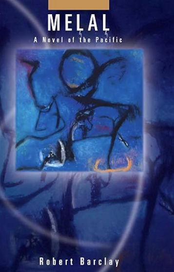
Plot: On Good Friday, 1981, Rujen Keju and his two sons come face to face with their complicated inheritance–one that includes years of atomic testing and the continued military presence of the U.S. in the Pacific. In this highly original work of history and adventure, novelist Robert Barclay weaves together characters and stories from mythological times with those of the present-day to give readers a rare and unsparing look at life in the contemporary Pacific.

To know more…
- 📕 For the Good of Mankind: A History of the People of Bikini and their Islands (Jack Niedenthal) — A Marshallese authoring the legacy of Bikini’s displaced community.
- 📕 Marshall Islands Legends and Stories (Daniel A. Kelin II) — Folklore collection for cultural immersion.
- 📕 Surviving Paradise: One Year on a Disappearing Island (Peter Rudiak-Gould) — A foreign teacher’s humorous and profound year on Ujae.
- 📕 Breaking the Shell: Voyaging & Refugees (Gen Zingel) — Tales of navigation heritage and refugee realities.
- 📕 Paradise Lost: A Year on a Vanishing Island (Alan Taylor) — Residency reflections on climate impact and tradition.
- 🎬 Kwajalein WWII Documentaries (YouTube) — Historic footage and expert commentary on atoll battles.
- 🎬 Marshallese Cultural Videos (YouTube) — Canoe-building, dance, and ceremony—ideal for pre-trip cultural context.